Bakersfield School Corridor Safety and Mobility Project

Case Study

Bakersfield School Corridor Safety and Mobility Project

Client

City of Bakersfield

Consultant

Kimley-Horn

Location

Bakersfield, California
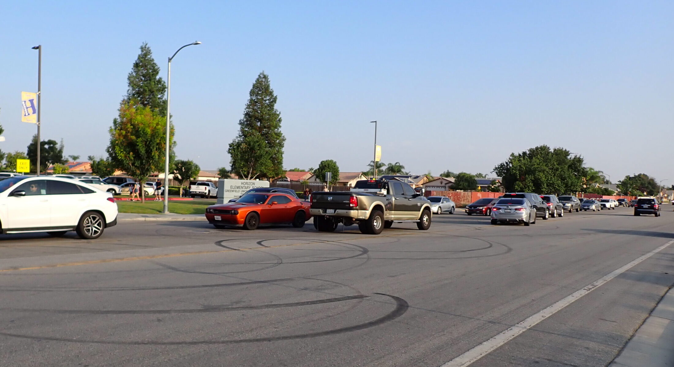
The Challenge

Bakersfield needed an accessible, scalable way to gather and organize feedback from diverse stakeholders along a complex, school-heavy corridor.

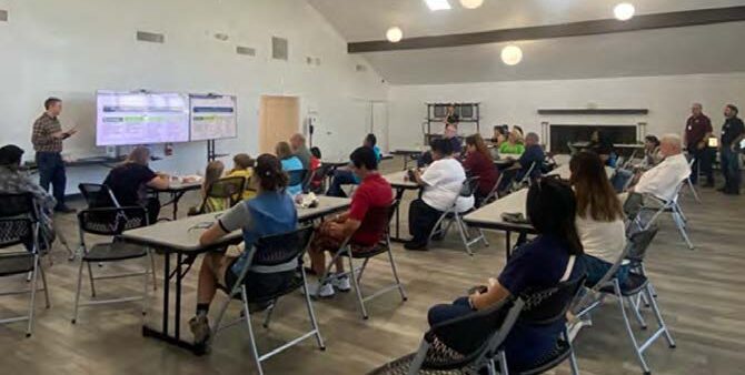
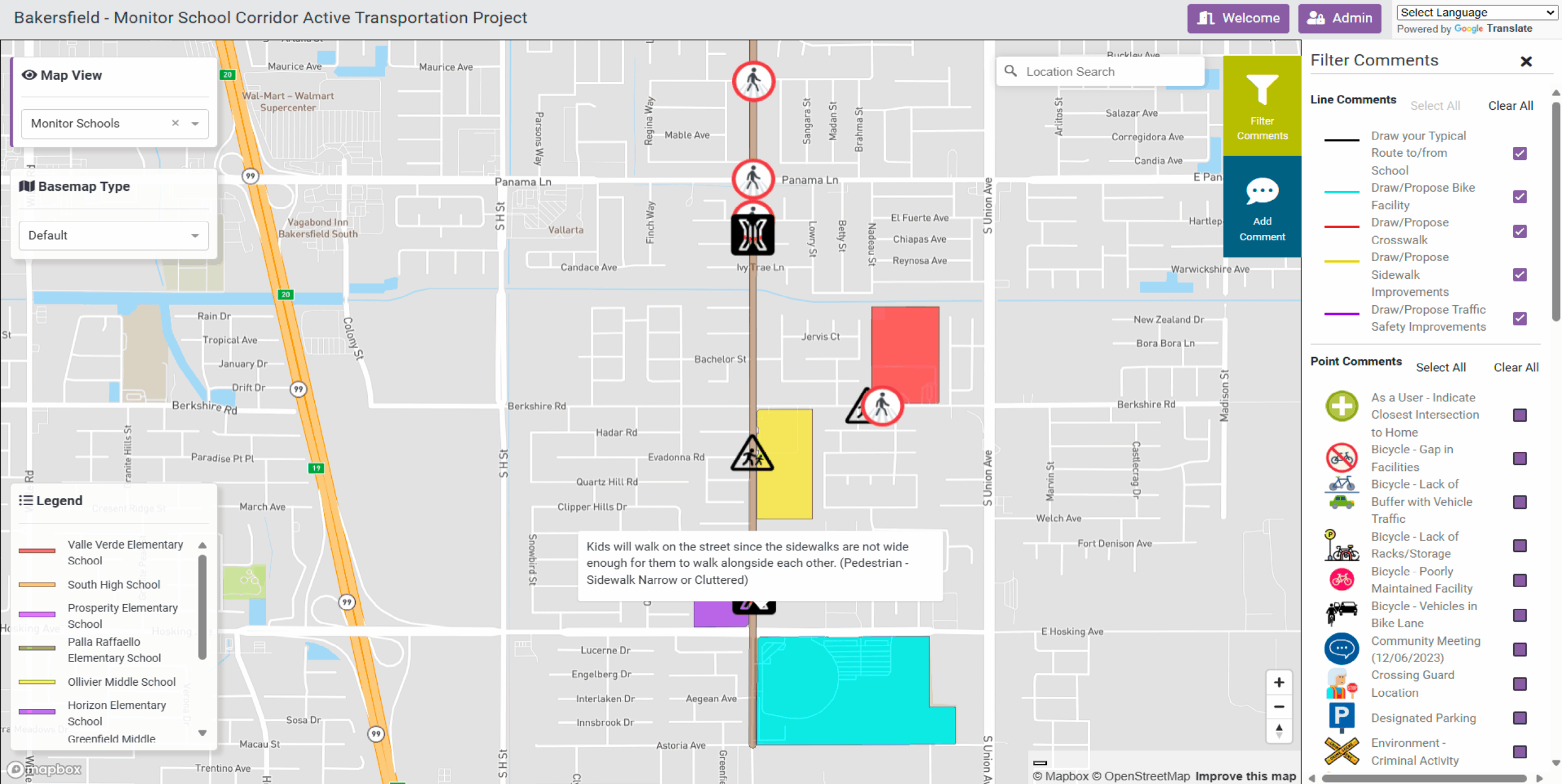
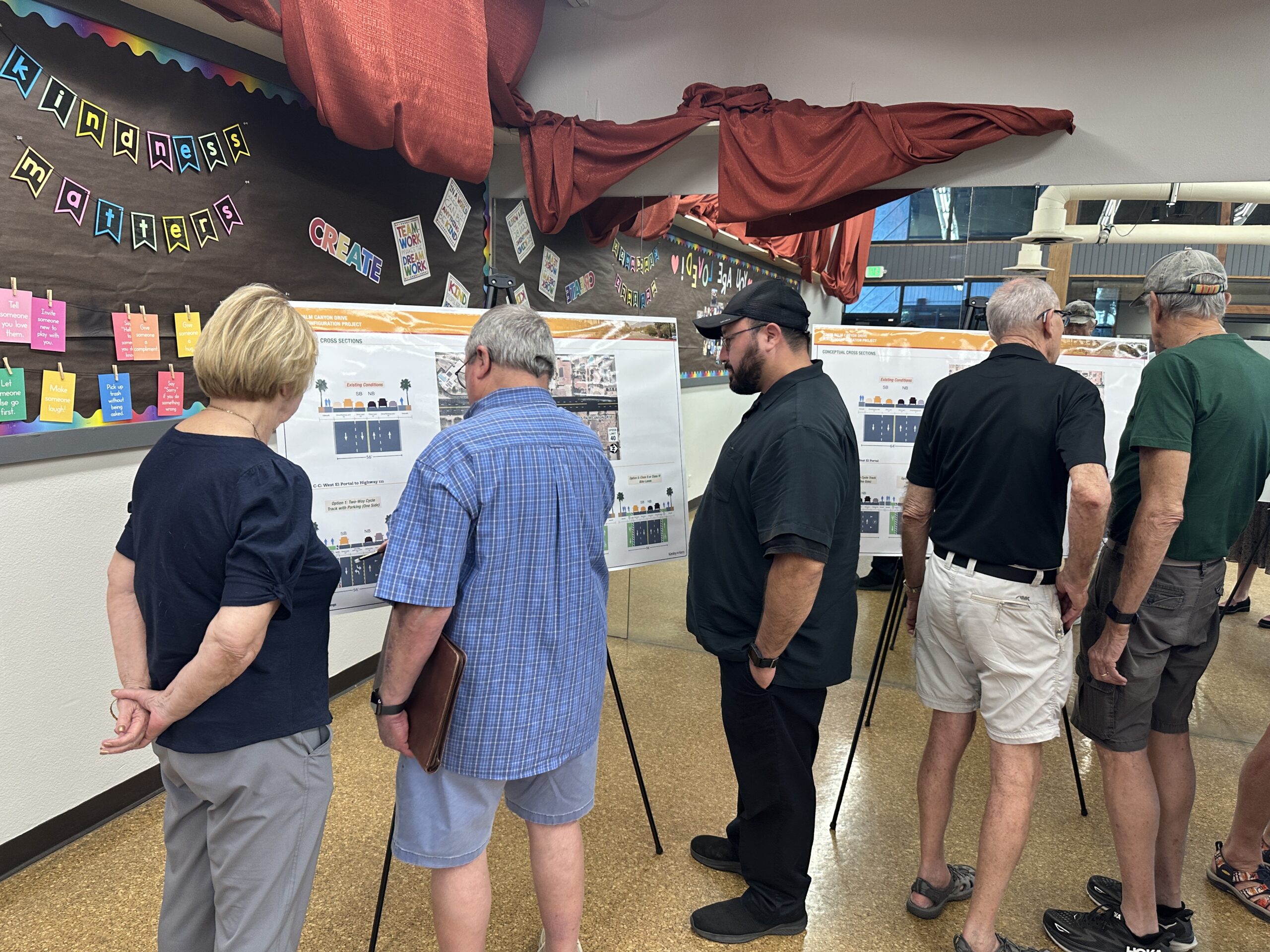
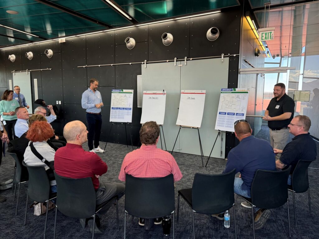
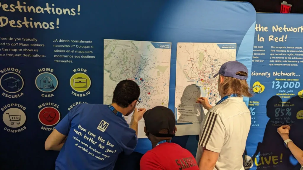
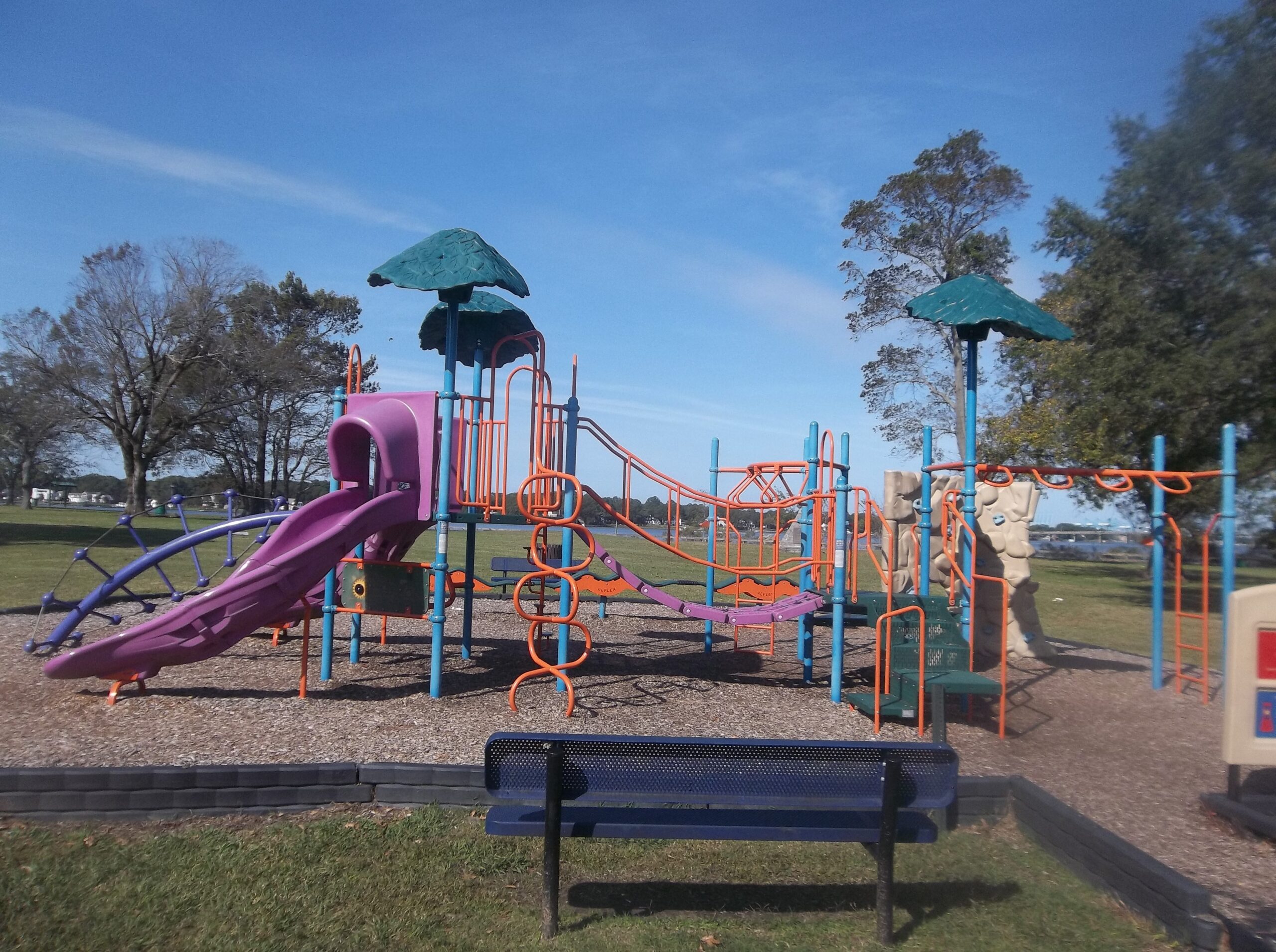
The City of Bakersfield endeavored to transform a three-mile corridor in the southeast part of the city—featuring nine schools and several residential areas—into a multimodal route. Traditionally, the City relied on in-person workshops and pop-up events to gather public input, which limited accessibility and inclusivity. Bakersfield officials also didn’t have a comprehensive method to collect and organize feedback from a broad range of stakeholders, such as school districts, parents, and local organizations.
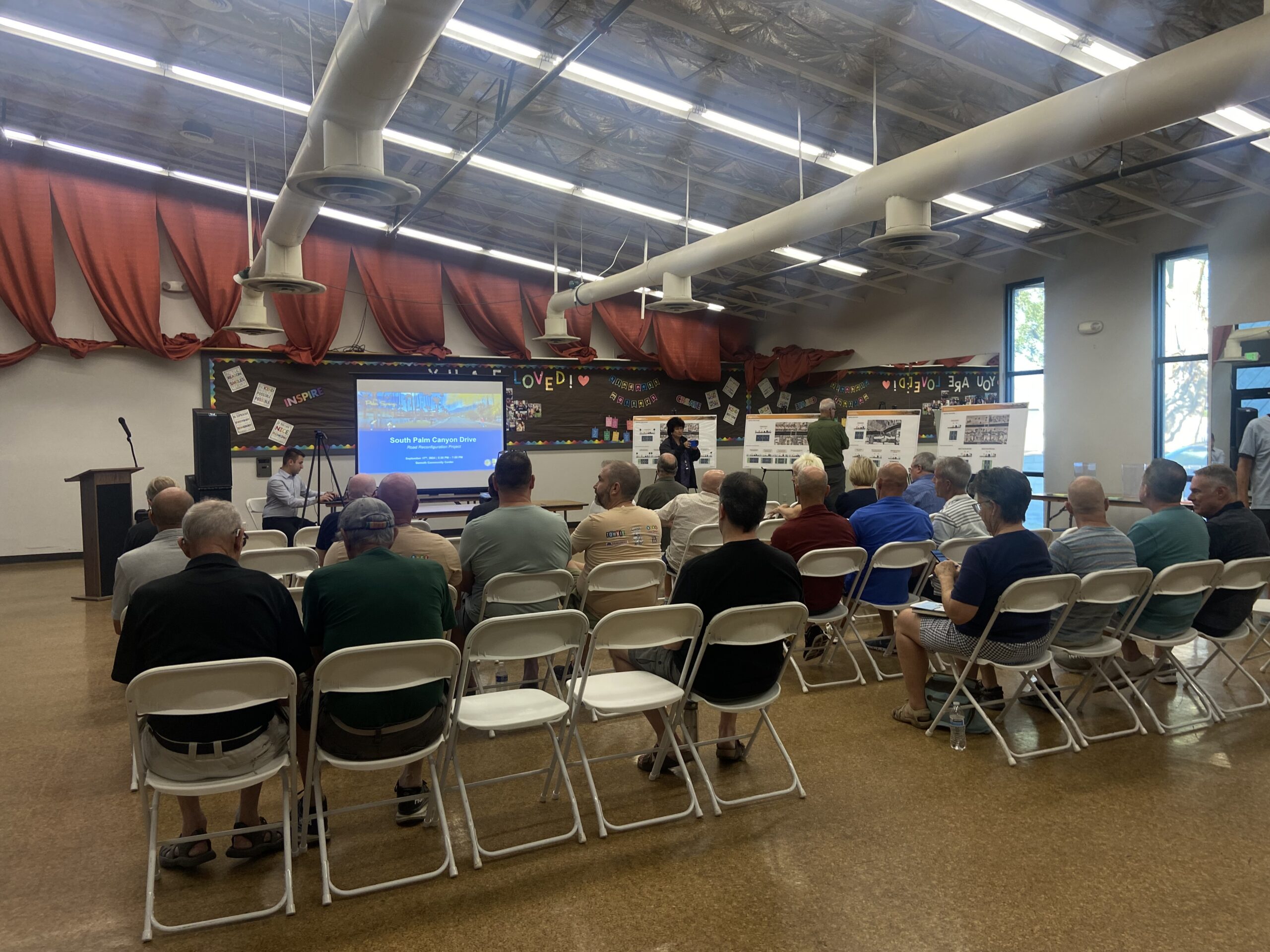
Our Solution

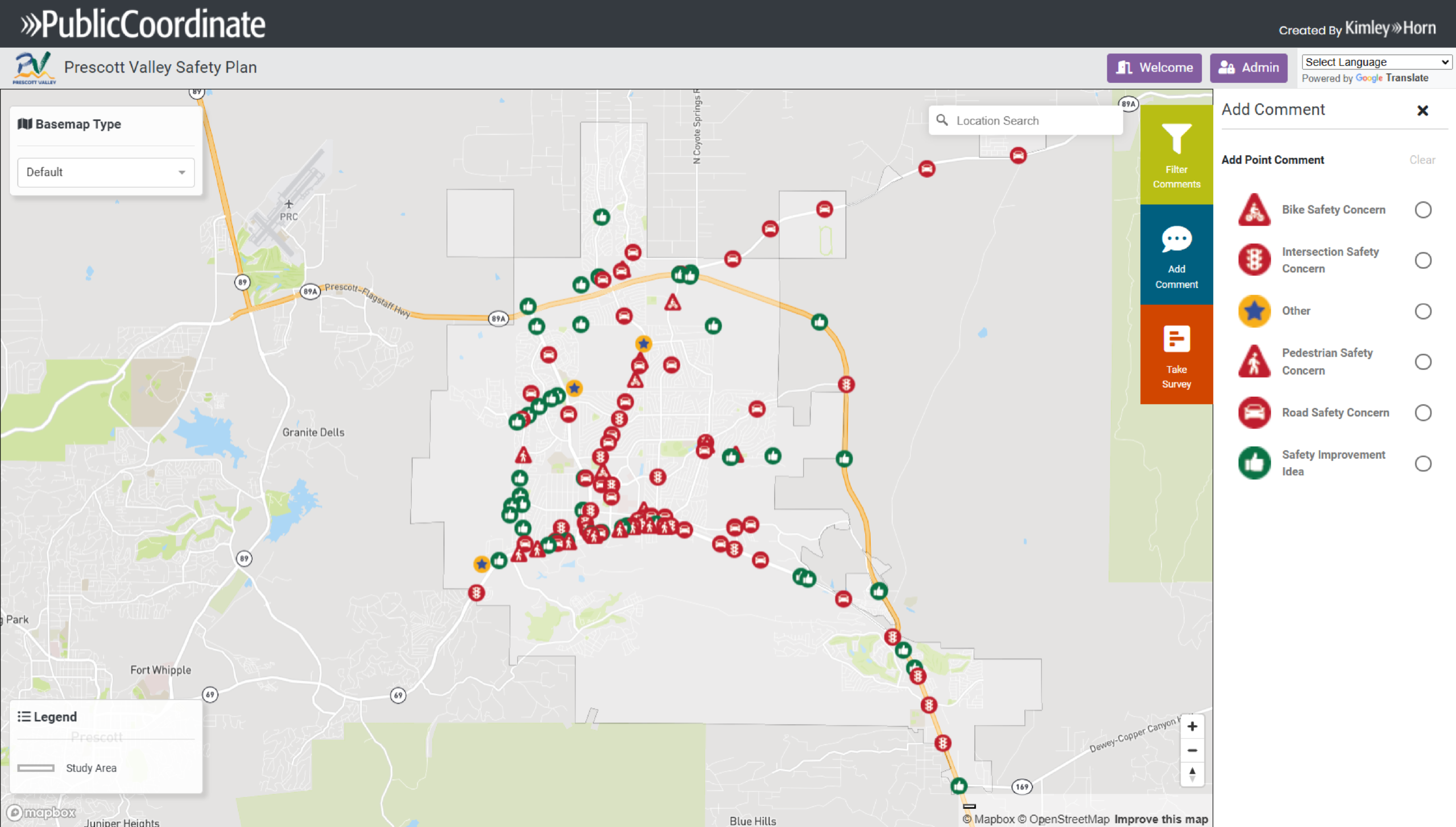
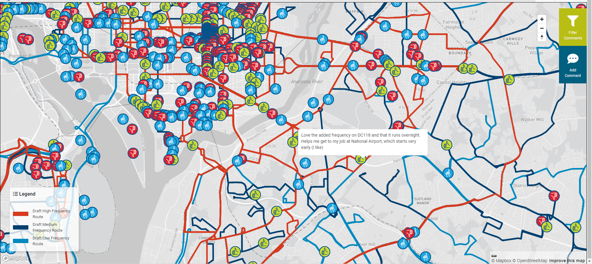
PublicCoordinate provided an interactive, map-based platform that streamlined community input and enabled real-time feedback from residents and stakeholders.

PublicCoordinate streamlined and enhanced public engagement through its platform, which allowed residents and stakeholders to leave comments directly on an interactive map. Layers were created for each school that reflected specific concerns, such as poor street lighting, traffic congestion and speeding, and inadequate parking. The tool was accessible online for five months, allowing input from those unable to attend in-person events. PublicCoordinate also facilitated real-time feedback during stakeholder meetings as school districts and community groups gathered and shared insights.

The Impact

PublicCoordinate empowered Bakersfield to ground its design process and funding efforts in clear, community-driven priorities.

With PublicCoordinate, the City of Bakersfield was able to access a centralized database of community feedback, which helped the City understand and prioritize traffic safety, bike lanes, and pedestrian infrastructure concerns. This data not only informed the design process but also strengthened the City’s grant applications by demonstrating community-driven planning. Although the project is still in the design phase, its early, community-led engagement has laid a strong foundation for responsive and inclusive urban development.

©Copyright 2021-2025 | KHTS, Inc. All Rights Reserved.

Dunedin Citywide Multimodal Transportation Plan

Case Study

Dunedin Citywide Multimodal Transportation Plan

Client

City of Dunedin

Consultant

Kimley-Horn

Location

Dunedin, Florida

The Challenge

Dunedin needed a reliable way to capture location-specific community concerns to guide a comprehensive update to its multimodal transportation master plan.

Dunedin, a city on Florida’s Gulf Coast renowned for its beaches and active community, wanted to update their citywide multimodal transportation master plan to better understand and address the community’s needs. This transportation master plan would need to prioritize safety issues, ensure that public funds were used effectively, and reflect feedback gathered about location-specific concerns.

Our Solution

PublicCoordinate provided a centralized digital platform that enabled Dunedin to efficiently gather and analyze community input for the master plan update.

Kimley-Horn, the City’s trusted consultant, recommended using PublicCoordinate as a digital environment to engage the community and collect valuable feedback. This platform allowed the City to gather community feedback about transportation-related concerns and publicly source recommendations as critical data to present to the City’s elected officials for decision making.

The Impact

Community-driven insights gathered through PublicCoordinate led to more informed recommendations, helping Dunedin advance a safer, more responsive multimodal transportation system.

By leveraging feedback gathered through PublicCoordinate, social media platforms, email, and in-person activities, the City launched a successful community engagement campaign that empowered residents to voice their concerns about specific areas, helping Dunedin collect the data needed to secure additional funding from City officials. Beyond funding, the tool provided insights into safety issues that traditional data often overlooks, such as near misses and everyday hazards experienced by pedestrians and cyclists. This community feedback enabled Kimley-Horn to refine recommendations, including improvements to bike and pedestrian infrastructure, safer crossing, and intersection upgrades. Using PublicCoordinate, Kimley-Horn addressed safety concerns, making Dunedin’s transportation system more responsive and inclusive.

©Copyright 2021-2025 | KHTS, Inc. All Rights Reserved.

South Palm Canyon Drive Road Reconfiguration Project

Case Study

South Palm Canyon Drive Road Reconfiguration Project

Client

City of Palm Springs

Consultant

Kimley-Horn

Location

Palm Springs, California

The Project

To guide the revitalization of a key transportation corridor, the City of Palm Springs launched a community-driven planning and design effort.

The City of Palm Springs, a desert resort city known for its thriving retirement community and cultural scene, needed support to plan, design, and implement pedestrian-friendly infrastructure—such as bike lanes, safety improvements, and visibility enhancements—along an outdated corridor. Their goal was to conduct community outreach to identify and propose a design concept amenable to the community that met their needs, but the project team needed a way to gather responses from the population and identify challenges and opportunities along the corridor.

The Challenge

While in-person community meetings were scheduled to best capture public input, the City also needed to reach all residents through an online engagement tool that could be accessed on the Engage Palm Springs webpage.

Our Solution

PublicCoordinate provided a unified platform for gathering community insights, guiding the development of responsive and data-driven corridor design alternatives.

Using PublicCoordinate, feedback was collected to identify challenges with vehicle mobility, pedestrian infrastructure, and traffic congestion, which supported the creation of new bike lanes. The project team presented multiple context-sensitive design alternatives for bike lane improvements to the public, allowing residents to review existing and proposed corridor conditions and provide feedback. By leveraging engagement through three in-person community meetings and extensive online comments, the team ensured the final design was informed by robust, segment-specific feedback. This enabled the project team to identify specific challenge areas and opportunities, ultimately determining a preferred concept that reflected the community’s priorities and addressed local concerns.

The Impact

The City’s use of PublicCoordinate led to a community-backed design solution that strengthened decision-making and set the project up for successful implementation.

By using PublicCoordinate, the City gained a clear understanding of specific challenge areas along the corridor and utilized the feedback provided by the local community to select the most impactful bike lane design. The South Palm Canyon Drive Road Reconfiguration project has completed the planning and design concept phases, and the City plans to continue using PublicCoordinate and the Engage Palm Springs webpage to communicate project updates to the community as the reconfiguration project progresses through design.

©Copyright 2021-2025 | KHTS, Inc. All Rights Reserved.

Improving Roadway Safety in Prescott Valley

Case Study

Improving Roadway Safety in Prescott Valley

Client

Prescott Valley

Consultant

Kimley-Horn

Location

Prescott Valley, Arizona

The Challenge

Prescott Valley needed a way to capture community-reported safety concerns to strengthen its SS4A-funded roadway safety action plan.

Prescott Valley, a growing community near the Grand Canyon known for its outdoor recreation, received the federal Safe Streets for All (SS4A) grant to improve its transportation infrastructure. With the grant, Prescott Valley’s goal was to develop a comprehensive safety action plan that identified and recommended solutions for roadway crashes in its urban and rural areas. While there was existing data for fatal and serious injury crashes, there needed to be a method to capture community-reported safety concerns not typically reflected icrash report statistics.

Our Solution

PublicCoordinate enabled Prescott Valley to gather resident-reported crash locations and safety concerns directly and efficiently.

Kimley-Horn, Prescott Valley’s safety action plan consultant, leveraged PublicCoordinate to collect feedback and pinpoint additional crash locations, near-misses, and other roadwayrelated safety concerns directly from residents. 

The Impact

Community insights gathered through PublicCoordinate helped Prescott Valley prioritize safety improvements and strengthen planning across future transportation projects.

By using PublicCoordinate, the team understoothe additional safety concerns of the community. These insights provided elected officials with a clear visual representation of where safety enhancements should be prioritized. The success of this approach led to Prescott Valley adopting PublicCoordinate in other transportationrelated infrastructure projects, enhancing transportation safety planning throughout the community.

©Copyright 2021-2025 | KHTS, Inc. All Rights Reserved.

City Park Reimagined: Portsmouth Master Plan

Case Study

City Park Reimagined: Portsmouth Master Plan

Client

City of Portsmouth

Consultant

Kimley-Horn

Location

Portsmouth, Virginia

The Challenge

An underused golf course occupying most of City Park prompted Portsmouth to rethink how its 90-acre waterfront space could better serve the community.

City Park in Portsmouth, Virginia, is an urban waterfront park spanning more than 90 acres. While certain features, like the picnic areas and playground, habitually engage community members, the golf course wasnused as much and didn’t reflect the recreational needs of the Portsmouth community. Since the golf course takes up a majority of City Park’s blueprintthe City of Portsmouth wanted to reimagine the park through a master planning process to better serve its 100,000 residents and transform the space into a more inclusive community asset. 

Our Solution

PublicCoordinate empowered Portsmouth to gather interactive, location-specific community input and share design alternatives for the future of City Park.

To support the City’s vision, PublicCoordinate was used in the early phases of the project to gather community input. The community engagement platform allowed residents to virtually interact with aerial map imagery and leave location-specific feedback, which was especially valuable during the COVID-19 pandemic. During a later phase, the team integrated concept drawings into the platform, allowing the City to present project alternatives to the public and give them a voice in the future of City Park. 

The Impact

Community-driven insights reshaped City Park’s future, replacing the unused golf course with vibrant spaces that better reflect local needs and bring residents together.

PublicCoordinate played a key role in shaping the new vision of City Park by enabling accessible and interactive community input. Instead of the golf course, the public identified park concepts with the greatest potential for their community, like spaces for families to gather, eat, and playprioritizing outcomes that promoted group activities that brought the community together.The insights that were gathered during this process not only informed the park design and construction outcomes for the Citybut it gave the community a say in what the future of their park would look like—creating a more meaningful space that directly addresses community needs.  

©Copyright 2021-2025 | KHTS, Inc. All Rights Reserved.

Leveraging Our Interactive Mapping Tool for a Better Bus Network

Better Bus learning session using PublicCoordinate

Case Study

Leveraging Our Interactive Mapping Tool for a Better Bus Network

Client

Washington Metropolitan Area Transit Authority (Metro)

Consultant

Kimley-Horn

Location

Washington, DC metropolitan area

Challenge

Metro wanted to revitalize their bus network in the Washington, DC metropolitan area to better support community needs and modernize the system, but it needed a strategic and simplified platform to engage with the public and collect feedback.  

Solution

Through PublicCoordinate’s accessible online mapping tool, community members and stakeholders were able to leave feedback on the proposed bus network—both on the overall network map and on specific routes that would most impact their neighborhoods. 

Impact

Metro received more than 8,000 route comments, with the majority coming via PublicCoordinate, simplifying the engagement process for the community and streamlining data collection and analysis for service planners. 

The Challenge

The bus system is an integral element of Washington, DC's transportation infrastructure—but Metro recognized there was a need for widespread changes.

Metro strategized a phased plan to design a modernized bus network that considers regional growth, technology, passenger service needs, route comprehensibility, and more. To accomplish all of this in partnership with the community, Metro launched the Better Bus Network Redesign to transform bus service throughout the region. 

One of Metro’s communication and outreach goals for the bus network redesign was to prioritize a wide range of customer perspectives, so they needed a way to capture feedback from people across a diverse and complex region. Along with public engagement events throughout the service area, Metro wanted to use a virtual platform that would allow people to leave comments at specific points on the map and let service planners extract route-specific data in an efficient way. 

Our Solution

Kimley-Horn worked with Metro on the Better Bus Network Redesign, including selecting a user-friendly community engagement tool. 

In partnership with WBA Research, Kimley-Horn, a firm specializing in engineering, planning, and design consulting, contributed expertise in identifying and assessing interactive tools and methods for route visualization. Participants in the research study provided favorable feedback regarding PublicCoordinate, which delivered the public engagement and data analysis functionalities that Metro required.  

PublicCoordinate allowed the public and stakeholders to explore the proposed bus network, compare the proposed changes to existing routes, and provide feedback all in one view. Commenters were also able to use a drop-down menu to view a route in isolation from the entire network, enabling them to leave comments at specific places in their neighborhoods regarding bus stops, bus lanes, service requests, and more through the “Comment on Your Route” feature.  

With support from Kimley-Horn and the power of PublicCoordinate, Metro requested feedback on the proposed bus network through an online marketing campaign. The Better Bus Network Redesign also included in-person engagement workshops and events planned by NeoNiche Strategies, particularly targeting regions that would experience the most change. The outreach events—which also offered community entertainment, activities, and food—drew in hundreds of people across the Washington, DC metropolitan area and offered stations where people could interact with PublicCoordinate and explore the proposed bus network in real time. Facilitators from Kimley-Horn and Foursquare Innovative Transportation Planning walked people through potential changes and captured their quantitative and qualitative feedback to provide greater depth to the overall data analysis.  

The Impact

By using PublicCoordinate, Kimley-Horn streamlined data collection and analysis and created an interactive and accessible way for the community to provide feedback on the draft Visionary Network.

Approximately 3,000 comments were left on the map of the full proposed network, and the public also left thousands of comments on individual routes that would impact their transit journeys the most. Overall, more than 8,000 comments on routes were collected through multiple sources, with 77% of all comments coming from the “Comment on Your Route” feature.

The use of PublicCoordinate also allowed for a more efficient data analysis process after the public engagement period ended. The project team partnered with PublicCoordinate software developers to make specific customizations, like automation features that supported the processing of thousands of geographically-tagged comments. Through this automation, a dashboard was created for Metro to regularly visualize comment numbers, general comment themes, and charts. Service planners then used the dashboard to filter for specific routes, perform keyword searches, read the comments, and identify pain points that needed attention.

This public engagement process helped Metro clearly understand how current riders reacted to the proposed changes, paving the way for a better bus network that reflects the local community and their needs, ideas, and aspirations.

©Copyright 2021-2025 | KHTS, Inc. All Rights Reserved.

Get In Touch

Want to learn more about PublicCoordinate, schedule a demo, or ask a question? Fill out the form below and a PublicCoordinate representative will be in touch shortly.