The Map That Talks Back
Transform the way you engage, gather insights, and make decisions with every conversation your project inspires.
Why PublicCoordinate?
PublicCoordinate empowers organizations to communicate and visualize project information, collect valuable public input, and make data-informed decisions based on real-time information. Built for flexibility, the platform is accessible, adaptable, and designed to meet the needs of projects of any scale.
Showcase Project Information with Interactive Maps
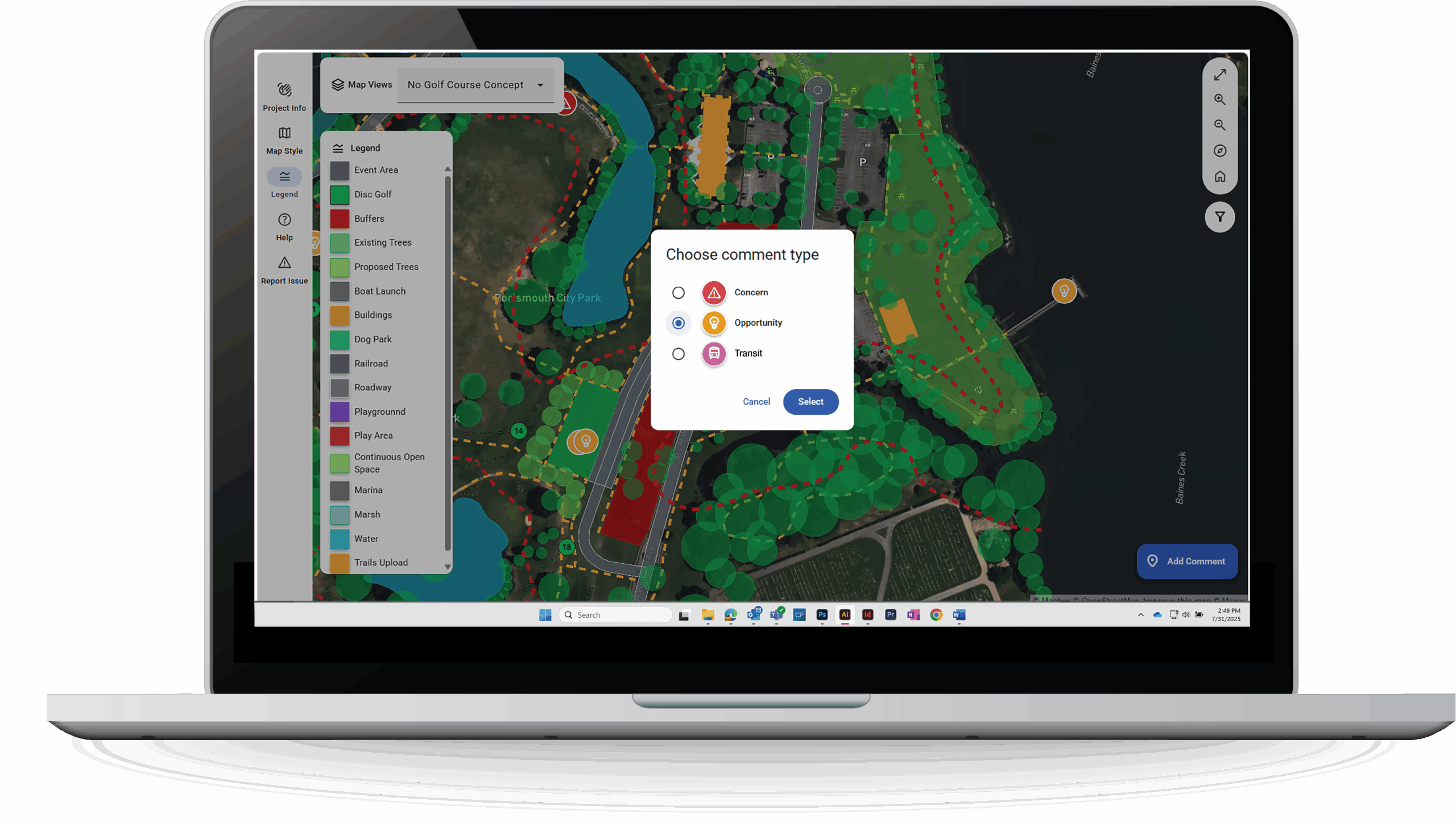
Customize map interfaces to share project information with the public
- Display project details, concept plans, and alternatives
- Toggle between different scenarios and phases
- Include a customized legend to guide users through their feedback journey
Dedicated webpages that present individual project information
- Upload supplemental project information such as images, concepts, and project plans
- Display clear and dynamic instructions for public users based on project configuration
Gain Deeper Stakeholder Insight
Support dynamic stakeholder feedback
- Empower the public and project stakeholders to leave location-specific comments, respond to surveys, and vote on ideas
Track feedback and engagement data across multiple project phases
- Organize and evaluate public input to easily identify concerns, themes, and opportunities all in one place.
Utilize integrations for a more customized experience
- Categorize and mediate public input with AI-assisted comment moderation
- Collect deeper insights with integrated surveys
Make Data-Driven Decisions
Visualize results at-a-glance through dynamic admin dashboards
- Track new comments, activity trends, and sentiments
- Understand stakeholder priorities through detailed breakdowns of comment categories and public sentiment
Export insights for deeper analysis and reporting
- Convert map comments and survey responses into digestible data from stakeholders
Break Down Engagement and Communication Barriers
Present project information to all users, regardless of ability or language
- Optimize accessibility with automatic language detection and translation, high contrast color schemes, and screen-reader capabilities
Make project information accessible and shareable
- Generate QR codes and shareable links
- Integrate maps and projects into both digital and printed project materials
- Tailor content to specific audiences
PublicCoordinate In Action
PublicCoordinate makes it easier than ever to communicate project information with the public and collect valuable stakeholder input. Whether the goal of the project is to inform, consult, or collaborate with communities and stakeholders, PublicCoordinate is suitable for all public engagement needs—from simple community outreach to complex multi-phase projects. Check out the sample map below to see PublicCoordinate in action.
Discover the Benefits of a Personalized Demo
Contact our team to arrange a closer look at how PublicCoordinate can transform your projects. We will customize the demonstration to fit your needs and answer any questions you may have. It’s a chance to learn more, with no obligation.
Get Started with Azure Marketplace
You can also explore PublicCoordinate directly through our Azure Marketplace listing to get started at your own pace.
©Copyright 2025 | KHTS, Inc. All Rights Reserved.