Case Study
Leveraging Our Interactive Mapping Tool for a Better Bus Network
Client
Washington Metropolitan Area Transit Authority (Metro)
Consultant
Kimley-Horn
Location
Washington, DC metropolitan area
Challenge
Metro wanted to revitalize their bus network in the Washington, DC metropolitan area to better support community needs and modernize the system, but it needed a strategic and simplified platform to engage with the public and collect feedback.
Solution
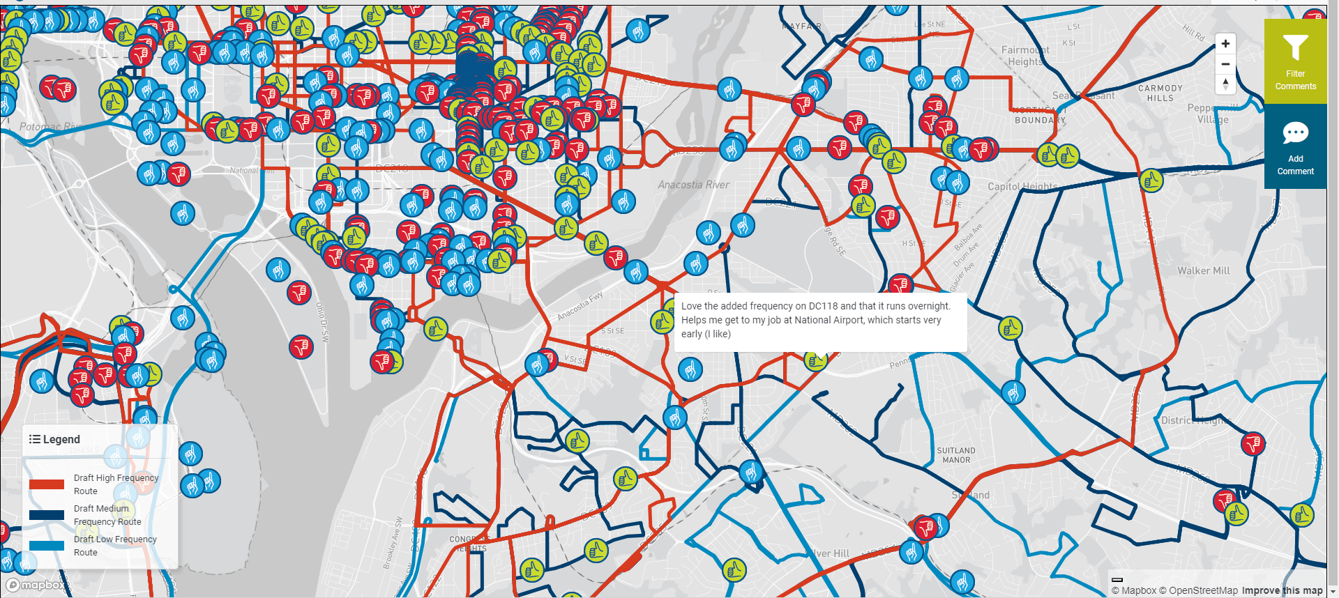
Through PublicCoordinate’s accessible online mapping tool, community members and stakeholders were able to leave feedback on the proposed bus network—both on the overall network map and on specific routes that would most impact their neighborhoods.
Impact
Metro received more than 8,000 route comments, with the majority coming via PublicCoordinate, simplifying the engagement process for the community and streamlining data collection and analysis for service planners.
The Challenge
The bus system is an integral element of Washington, DC's transportation infrastructure—but Metro recognized there was a need for widespread changes.
Metro strategized a phased plan to design a modernized bus network that considers regional growth, technology, passenger service needs, route comprehensibility, and more. To accomplish all of this in partnership with the community, Metro launched the Better Bus Network Redesign to transform bus service throughout the region.
One of Metro’s communication and outreach goals for the bus network redesign was to prioritize a wide range of customer perspectives, so they needed a way to capture feedback from people across a diverse and complex region. Along with public engagement events throughout the service area, Metro wanted to use a virtual platform that would allow people to leave comments at specific points on the map and let service planners extract route-specific data in an efficient way.
The Solution
Kimley-Horn worked with Metro on the Better Bus Network Redesign, including selecting a user-friendly community engagement tool.
In partnership with WBA Research, Kimley-Horn, a firm specializing in engineering, planning, and design consulting, contributed expertise in identifying and assessing interactive tools and methods for route visualization. Participants in the research study provided favorable feedback regarding PublicCoordinate, which delivered the public engagement and data analysis functionalities that Metro required.
PublicCoordinate allowed the public and stakeholders to explore the proposed bus network, compare the proposed changes to existing routes, and provide feedback all in one view. Commenters were also able to use a drop-down menu to view a route in isolation from the entire network, enabling them to leave comments at specific places in their neighborhoods regarding bus stops, bus lanes, service requests, and more through the “Comment on Your Route” feature.
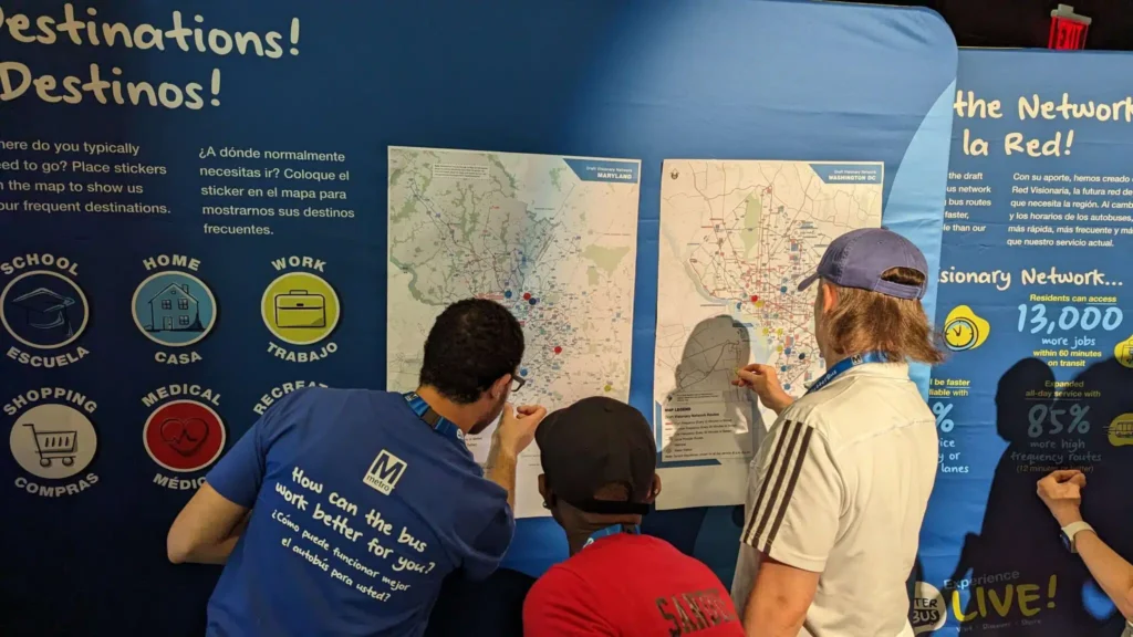
With support from Kimley-Horn and the power of PublicCoordinate, Metro requested feedback on the proposed bus network through an online marketing campaign. The Better Bus Network Redesign also included in-person engagement workshops and events planned by NeoNiche Strategies, particularly targeting regions that would experience the most change. The outreach events—which also offered community entertainment, activities, and food—drew in hundreds of people across the Washington, DC metropolitan area and offered stations where people could interact with PublicCoordinate and explore the proposed bus network in real time. Facilitators from Kimley-Horn and Foursquare Innovative Transportation Planning walked people through potential changes and captured their quantitative and qualitative feedback to provide greater depth to the overall data analysis.
The Impact
By using PublicCoordinate, Kimley-Horn streamlined data collection and analysis and created an interactive and accessible way for the community to provide feedback on the draft Visionary Network.
Approximately 3,000 comments were left on the map of the full proposed network, and the public also left thousands of comments on individual routes that would impact their transit journeys the most. Overall, more than 8,000 comments on routes were collected through multiple sources, with 77% of all comments coming from the “Comment on Your Route” feature.
The use of PublicCoordinate also allowed for a more efficient data analysis process after the public engagement period ended. The project team partnered with PublicCoordinate software developers to make specific customizations, like automation features that supported the processing of thousands of geographically-tagged comments. Through this automation, a dashboard was created for Metro to regularly visualize comment numbers, general comment themes, and charts. Service planners then used the dashboard to filter for specific routes, perform keyword searches, read the comments, and identify pain points that needed attention.
This public engagement process helped Metro clearly understand how current riders reacted to the proposed changes, paving the way for a better bus network that reflects the local community and their needs, ideas, and aspirations.
©Copyright 2021-2025 | KHTS, Inc. All Rights Reserved.