PublicCoordinate is an interactive map-based platform where public agencies and developers can share project information with the public to gather feedback. Users can customize it to their own projects, translate into multiple languages, upload project photos to the map, and export fully formatted reports with summary analytics. PublicCoordinate can be used for a wide variety of projects and is a great tool whether users are seeking to solicit input on a municipal project with multiple alternatives or share development information on a private project.
Key Features
PUBLIC-FRIENDLY
Translate map to multiple languages, meet web accessibility guidelines, and access on-the-go from any mobile device or desktop
CUSTOMIZABLE
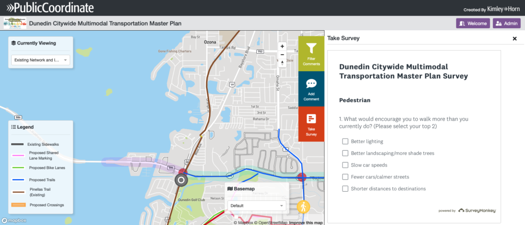
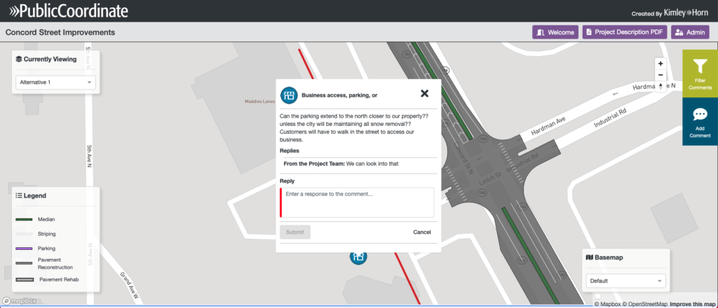
Toggle between multiple base maps, add various comment types and photos, display custom surveys, and add custom branding
SECURE
Increase security with an optional email address requirement to post a comment and enable a built-in prohibited words list to restrict inappropriate comments
EFFICIENT
Toggle between multiple project phases in one map to assign comments to specific phases, and export formatted reports on activity and comments with summary analytics
Collaborative Solutions
Streamline Public Engagement
Thanks to integrated survey and comment exporting features, the process for soliciting and summarizing public feedback is fast and easy.
Provide Accessibility to All
Enhanced features, including ADA web accessibility, and language translation, provide a more inclusive experience for users with disabilities, increases usability, and help users reach a wider audience.
Partner for In-House Support
Kimley-Horn develops and maintains the mapping software, so it is reliable and easy to discuss specific project needs or resolve issues quickly.
Live Map
With enhanced capabilities, minimal start up effort, and access across teams, PublicCoordinate is one of the most affordable mapping software solutions in the market. Explore the live map below or click here to see it in action.
Get Started
Submit the form below to get more information about how PublicCoordinate can help your agency make public engagement simple, affordable, and streamlined.